Map of Varanasi
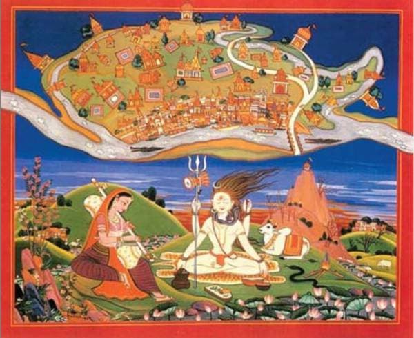
Have you ever seen an old Hindu map? I bet you haven’t seen anything like this one! “Indians had no knowledge of cartography before maps were introduced by Europeans”- said India’s first Prime Minister Jawaharlal Nehru. Well, he was wrong. Here is a traditional map of Varanasi made by Hindus in the 17th century. This painting depicts Lord Shiva and Goddess Parvati with Nandi in the background.
Standing on Shiva’s trident is the Holy city of Varanasi. It is surrounded by the river Varana in the north, river Asi in the South, and river Ganga in the east. In the north is depicted the temple of Omkareshvara and in the South is the temple of Kedareshvara. Manikarneshvara, Sangameshvara are also shown. Map also depicts the ghats of Varanasi. In this map primarily meant for pilgrims, civilian areas and crematorium are also shown. At the center of Varanasi was the most important Kashi Vishveshvara temple aka Kashi Vishwanath Temple (destroyed by Aurangzeb and replaced by Gyanvapi mosque in 1669).